ESTOFEX Outlook
Dagelijkse onweersverwachting van het European Storm Forecast Experiment (ESTOFEX) voor Europa.
Niveau 1
Van toepassing op Nederland
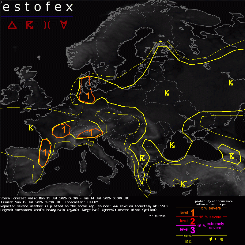
13 jul. 08:00 – 14 jul. 08:00 UTC
estofex.org →Veelgestelde vragen
ESTOFEX (European Storm Forecast Experiment) is een Europees vrijwilligersnetwerk van meteorologen dat dagelijks onweersverwachtingen uitgeeft voor Europa. De outlooks worden opgesteld door ervaren storm-forecasters en zijn gratis beschikbaar.
Niveau 1 betekent een kleine kans op georganiseerd onweer met lokale gevaren. Niveau 2 wijst op een verhoogd risico met kans op supercellen, grote hagel of zware windstoten. Niveau 3 is zeldzaam en geeft een zeer grote kans op uitzonderlijk gevaarlijk weer voor een groot gebied.
KNMI-waarschuwingen zijn officieel en gericht op de directe dreiging voor Nederland (code geel/oranje/rood). ESTOFEX richt zich op heel Europa en kijkt verder vooruit, met focus op de kans op extreme convectie. Beide zijn complementair.
Er zijn twee vaste outlooks: één voor de komende dag (Day 1) en één voor de dag daarna (Day 2). Incidenteel worden Day 3-outlooks uitgebracht bij bijzondere weerssituaties.